The breeze after the storm – it’s quite windy outside today and we’ll continue to have sporadic snow showers as well. Accumulations ranged from 3-4″ in Vermont to 18″ in Maine. Wind gradually subsides into the afternoon hours, and we shouldn’t have many issues with it for couple days.
Post-storm, we’re left with something just as good as natural snow – some deep cold. We have a cold air mass settled in today and it will actually hold tight through the midweek. Most of the Northeast will see strong snowmaking windows through Wednesday, with summit & overnight windows lasting through the end of the week. Outside of the Northeast, the windows will be short and likely during the overnight hours.
After all the storm attention and analysis, the rest of the weekend seems a little dry. But the cold air is welcomed after so much warmth and rain.
As far as precipitation goes, we’ll have some rain or snow showers coming Thursday with a weak front passing through. Another storm looks to be brewing this weekend, and unfortunately it looks rather warm and wet for now. There are some colder solutions for northern New England, however teleconnections don’t show much cold or blocking available, so my hunch is it will stay warm for the majority of us. Behind it, however, we should be seeing another deep batch of cold air.
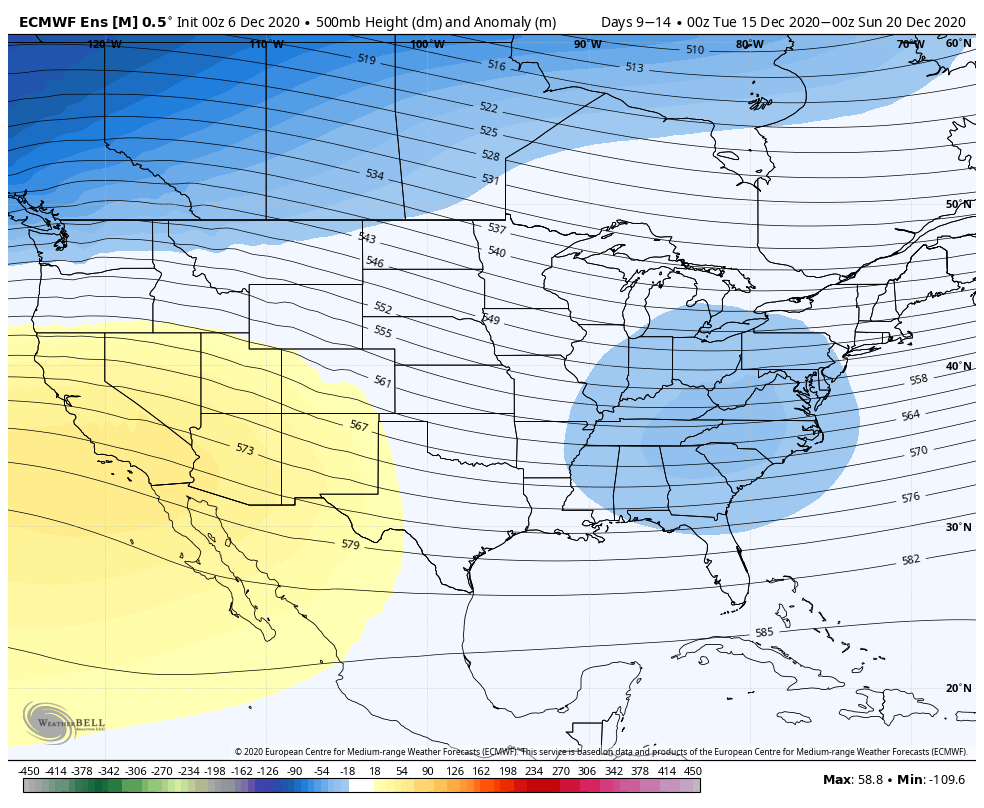
Our focus soon turns to the important holiday weeks at the end of the month. Currently, our pattern flip looks to be holding off at least to the weekend before Christmas. Below is the 500mb Height Anomaly. The 500mb level gives a good overview of the atmospheric flow. This gives some insight into the troughs and ridges in the pattern (troughs are negative anomalies and usually provide cooler air, ridges are positives and provide warmer air). While we’ll have a little hiccup in the cold this coming weekend, it does look like we return to a trough (some cold) heading into the following weekend. The pattern flip will come, however, at some point in late December or early January.