This morning we started off slightly cooler than expected with a late shift in the wind. With the southeast flow hanging on longer, temperatures are struggling to move. Once that breaks into the southwest flow, we’ll see temperatures move much quicker.
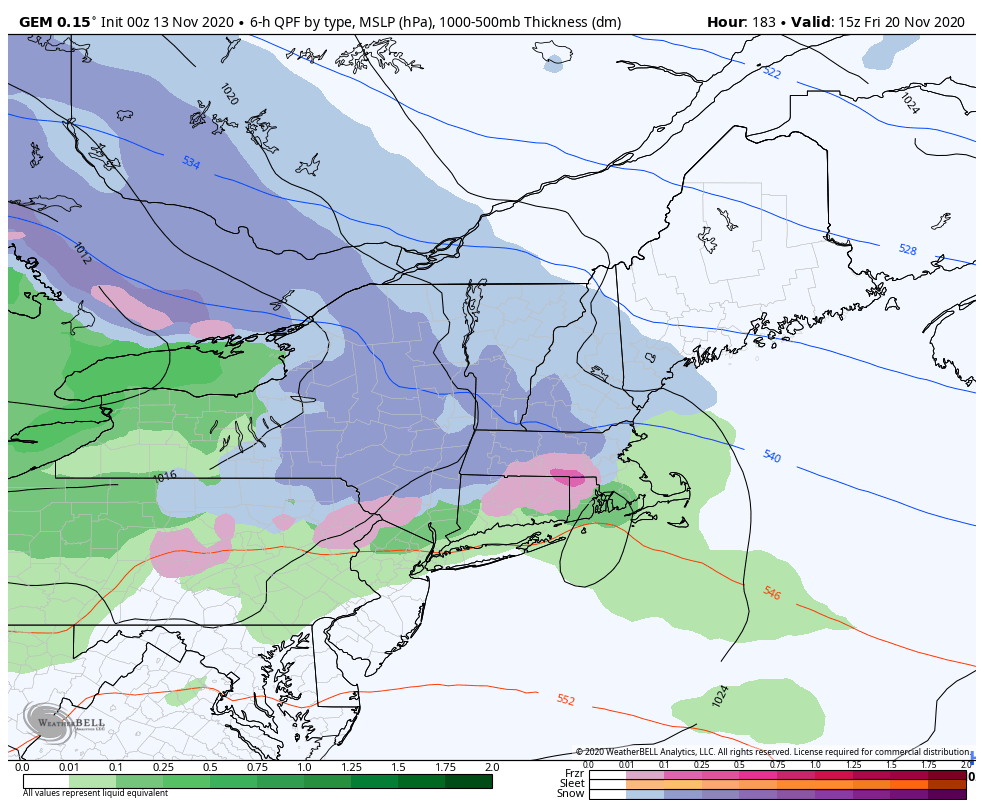
The cool-down following our system today, doesn’t truly settle in until during the day on Saturday. Latest indications show that the warm-up ahead of Sunday’s system looks to be less amplified, so we will keep temperatures close to the freezing mark at summit, though bases should allow for rain. Therefore some accumulation is possible into Monday, before the backside/lake-effect snows begin. Sugarloaf has the chance of seeing a moderate accumulation, with Sunday River and Loon also seeing that possibility, but not nearly as much. Once the backside snow begins, we could pick up 1-2″ at Boyne Highlands.
Our deepest cold of the season (so far) begins its journey into Michigan on Sunday, and New England on Monday, settling in deepest Tuesday night through Thursday morning.
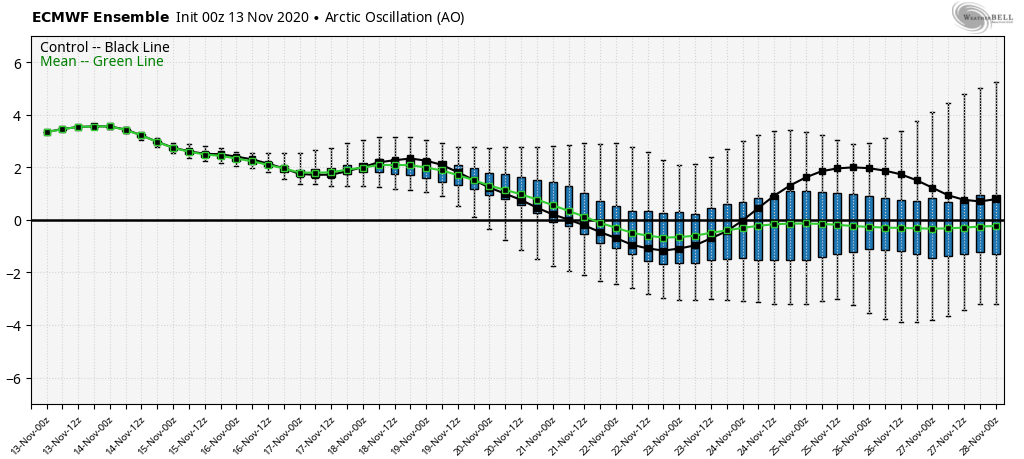
A low pressure system moving along this trough is going to be the deciding factor as to how much of this cold stays into Friday, and potentially gives us a light snow event, or if we warm up slightly, and end up with some rain. There has been some consensus on the former, and with another system quickly on its heels. Teleconnections show this as well, with a trough around 11/22-11/23.
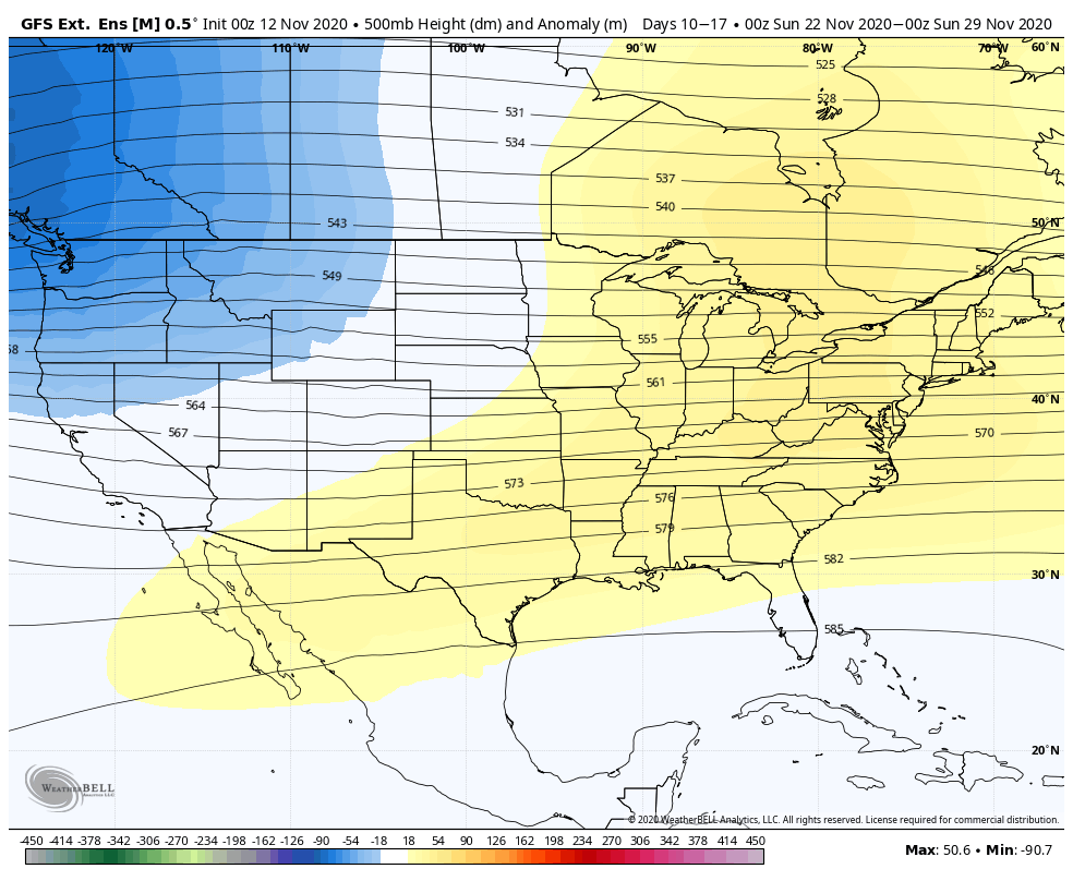
Therefore it doesn’t look like there will be much of a warmup at the end of next week, with the exception of temperatures coming up simply because of the moisture increase. We’re not in an arctic airmass, so dew points will be in the 20’s, bringing temperatures there as well. With nearly 5 days of temperatures dipping into lower ranges, the reverse is inevitable. It does look like we’ll have some warmth sneak in ahead of Thanksgiving weekend with a big of a ridge setting up. However, looking at the overall pattern into the last week of November, we’re developing a western trough. That should be able to eat into this ridge before too much warmth gathers up, and we’ll see more cold shots after Thanksgiving into the first week of December.