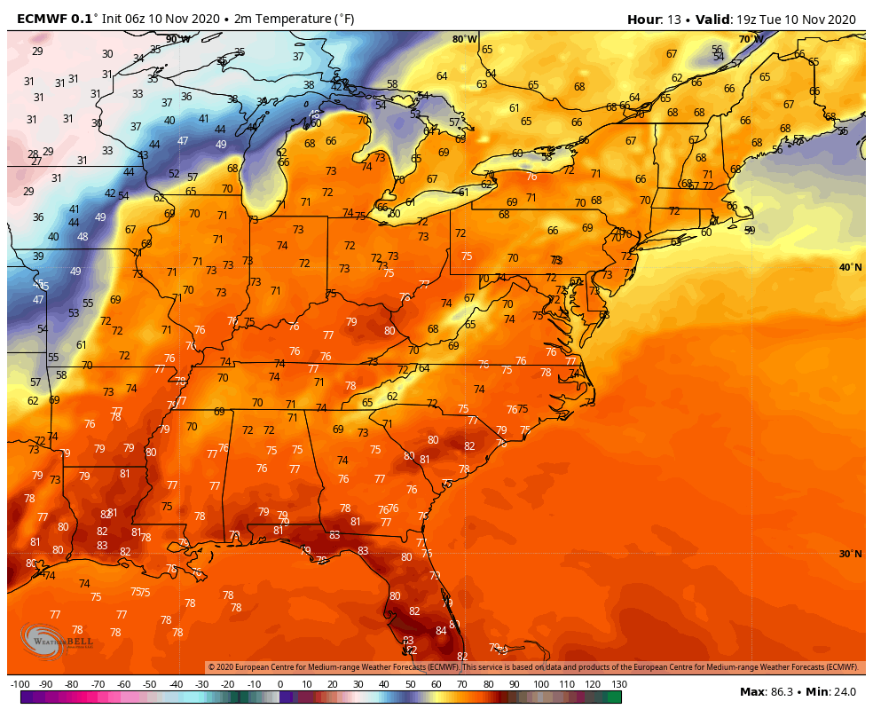
And so it begins! Transition week from early fall weather to late fall weather, and hopefully very few visitations back to early fall weather.
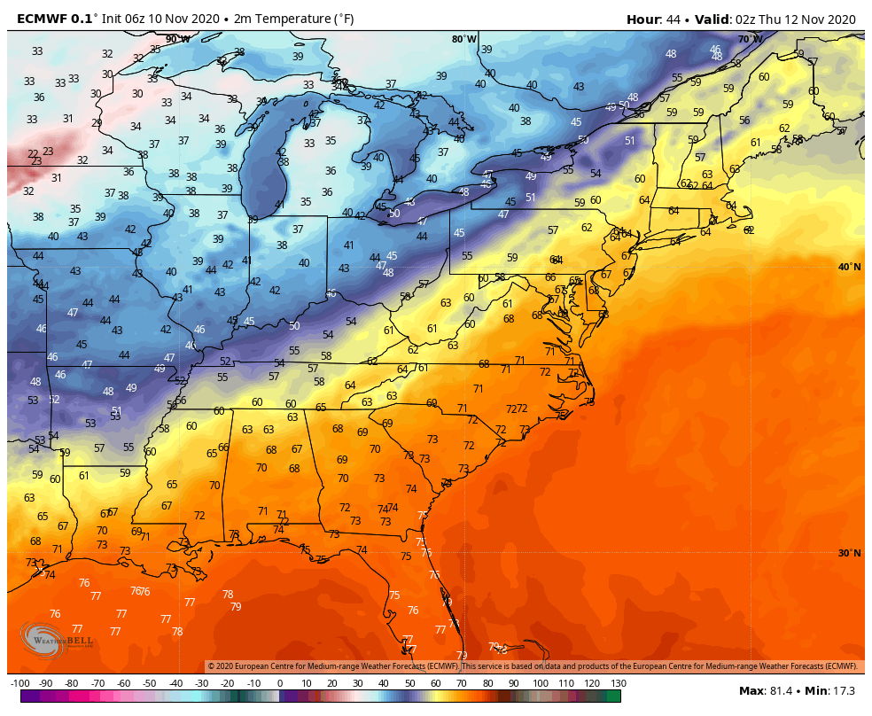
The warmth continues today as the front slowly makes its way through Minnesota, Iowa & Wisconsin this afternoon. During the overnight, the front will cross through Michigan. By Wednesday, we notice that the front is becoming more elongated E/W instead of the NE/SW orientation it has in the 11/10 image. Therefore, it will take a bit longer for temperatures to come down through the night Wednesday and into Thursday as the front slowly sags southward. That cool down isn’t one that will make waves for us, but rather the secondary front that comes through later Friday.
While temperatures should allow for summits and potentially some mid-levels to drop into snowmaking ranges, the cold is shunted out quickly with an approaching system later Sunday into Monday. This system may start out as snow or a mix, but eventually will change to rain for most if not all resorts by Monday morning (11/16), given the component of tropical energy from Eta mixed in. It will be after this system departs that we have our largest cold opportunity since the first few days of the month.