The warmth and sunshine continue through today (minus a few clouds in NH/ME) but otherwise it will be another sunny and warm day. High pressure is setting up shop for the weekend, however once it moves offshore next week, we’ll see the warmest air of this spell with return flow from the south. Highs may hit the 70’s at bases before this eastern ridge is all said and done with us. Our warmest day looks to be Tuesday, depending on the time of the first front.
By Monday, the high pressure is also helping to steer then Tropical Storm/Hurricane Eta.
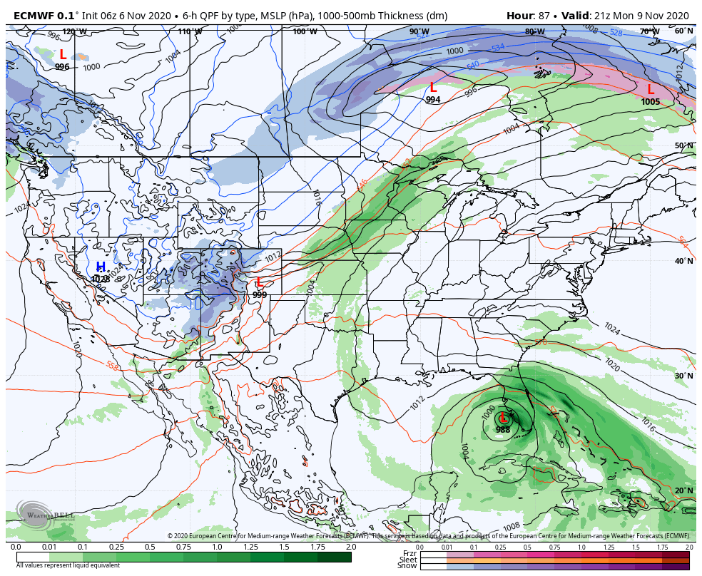

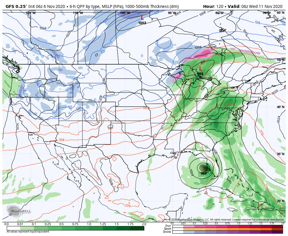
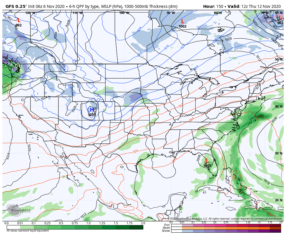
After a brief landfall or near miss to the Florida Keys this weekend, Eta will then hang out in the eastern Gulf for a few days, before getting picked up by the second piece of energy that ejects from out west at some point toward the end of next week. The first piece of energy comes through around 11/11, bringing mostly rain and only a small drop in temperatures for the east. Our system with the energy from Eta pushes through toward the end of the week, which drops temperatures again, but still remaining seasonable/seasonably warm. Once that pushes offshore over next weekend, we stop the battle with the tropics, and the trough out west can finally begin to spread east. Around the end of next weekend into the beginning of the following week (11/15-11/18), it looks as though we’ll finally have the opportunity for cold shots. They look to be inconsistent at first, but eventually settle in a bit deeper each time.
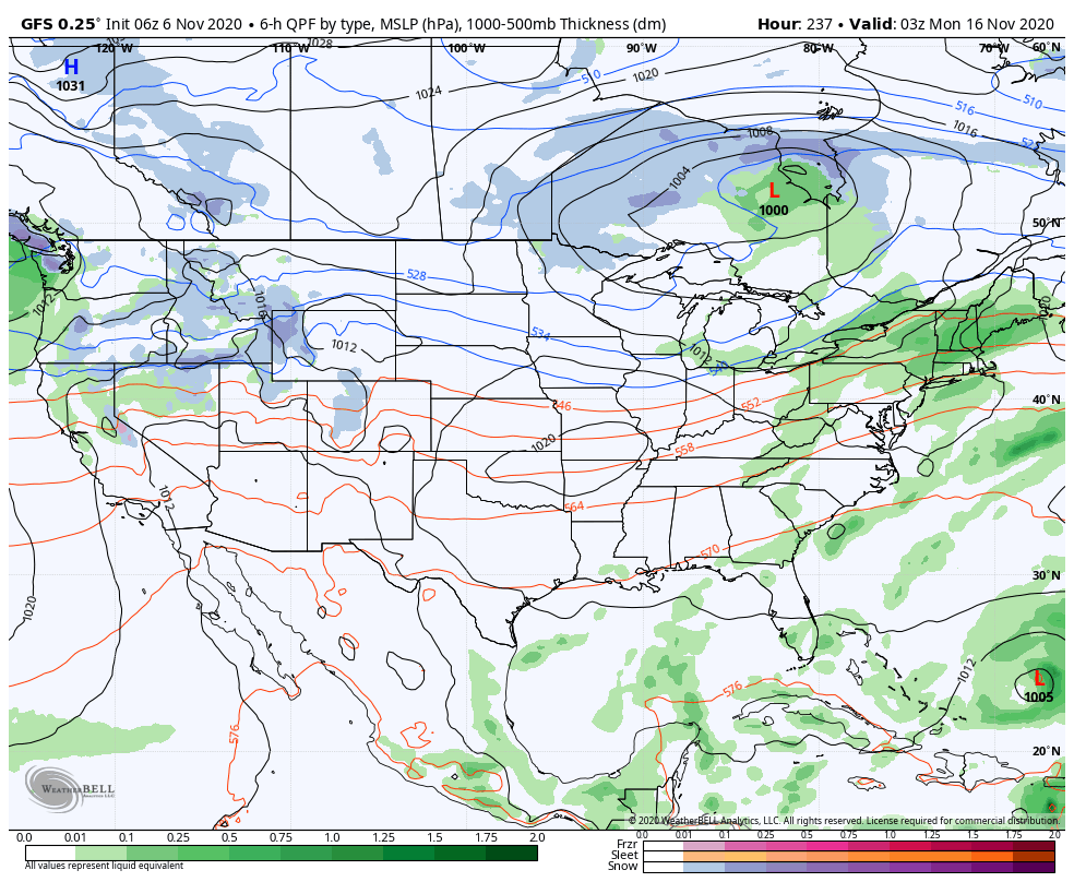
Why the inconsistency? Notice in the bottom right of the last map (11/15), there’s another low in the Atlantic. It does seem to sit and spin for some time. It’s not deep, but still possible it has tropical tendencies, which means it could interrupt some cold spells if wrapped up into another system. Also, our teleconnections aren’t very exciting. The NAO and AO (North Atlantic Oscillation/Arctic Oscillation) stay mostly positive, which doesn’t scream cold and/or snow. Now there are dips in them, where they get close to zero or slightly negative – and one date that correlates with several teleconnections is 11/17. Therefore I imagine our chance to get the guns on for some period of time is around then. However, I don’t anticipate it to stick around long. I believe we’ll have one or two more warm systems to come through before Thanksgiving, but that weekend should be somewhat of a turning point into early December.