Good morning! We are slowly but surely moving those temperatures up and out of our cool and breezy pattern that we’ve had over the past several days.
Expect temperatures today to reach into the 30’s and 40’s fairly easily at your bases, and even the 30’s at summits for northern New England. Outside of this area, heading south and west, you’ll likely see 50’s at your base. The warmth is setting in and only gaining strength throughout the next week.
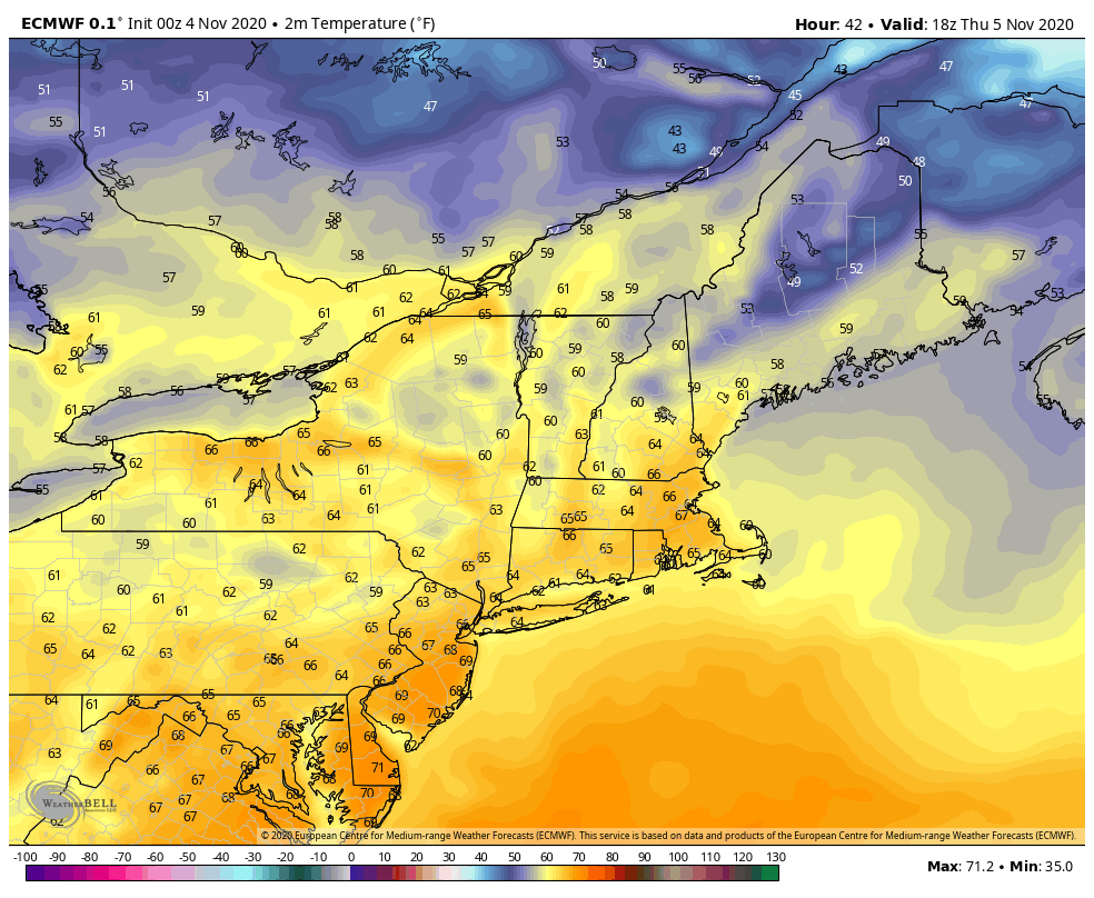
By Thursday, we could be seeing surface high temperatures of at least 60 degrees across all of the east at base areas. A gusty southwest flow will be persistent through the majority of the day before shifting west on Friday.
The warmest air of this moderation looks to come right before the cold front passes through mid to next week. Surface temperatures at that point may easily approach 70 degrees.
How deep the cold entrenches itself into the northeast with the front toward the end of next week still remains to be seen. Given the current pattern, it looks as though cold will continue to be inconsistent through the remainder of the month, but at least approach us more often than it will in the next 7 days.