Good (chilly) morning – temperatures took the expected nose-dive last night, and some bases even inverted allowing for some cool air to spill into all areas of the mountain.
Expect a quick warmup with sunshine all day today, especially at the base. We’ll keep the cooler air for a segment of tonight, though summits should steady off and even rise, and bases may invert initially before steadying and potentially rising (though the rise at the low levels should stay closer to sunrise).
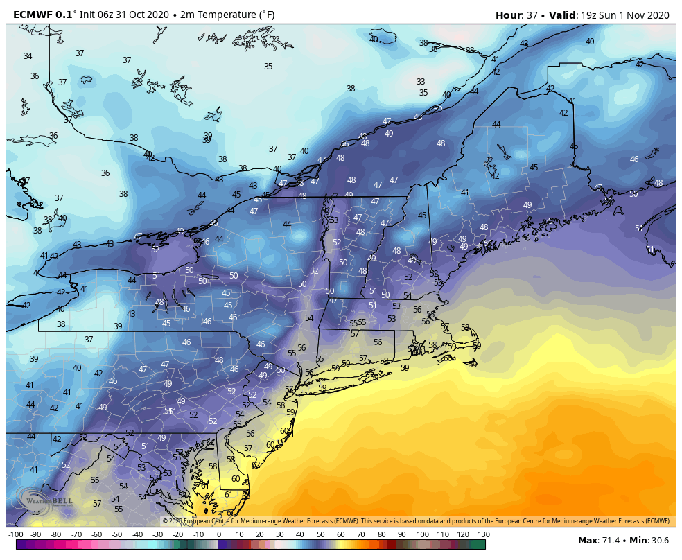
Sunday will be rather warm, compared to what we’re seeing today and what the forecast changes to on Monday. High temperatures at the base areas will likely get into the 40’s and even 50’s in some cases with strong southerly flow ahead of the low.
The low pressure that we were talking about in the video yesterday is developing a bit more substantially but farther offshore, so it’s not a help to us with much snowfall.
Rain ahead of the front should amount to .20-.40″ through the event with some snow showers on the backside for northern Maine, New Hampshire, and Vermont. This could accumulate to a couple inches.
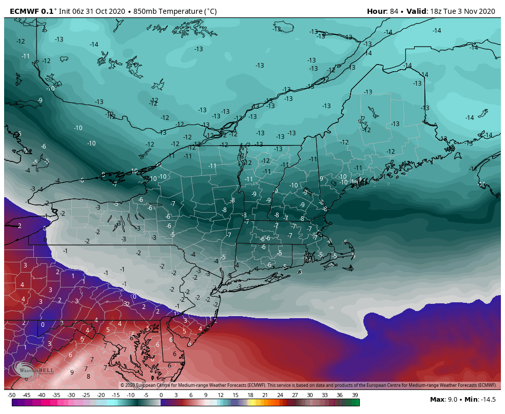
The cold that settles in Monday is going to be deeper than the cold that settled in last night. This cold air mass has a one-two punch of cold…one on Monday and another on Tuesday.
This batch of cold doesn’t penetrate as deep geographically, and will lift out quickly Tuesday night into Wednesday. Beyond that, the forecast has remained the same – moderating temperatures and minimal, if any, snowmaking windows through at least 11/12.