Unfortunately after our cold lifts on Wednesday, there’s not much, if anything to work with in terms of cold moving forward into the following 7-10 days. There’s a large ridge building out west without much resistance, and it stays in place for at least 7 days, which is what we saw last week in the long term blog as well.
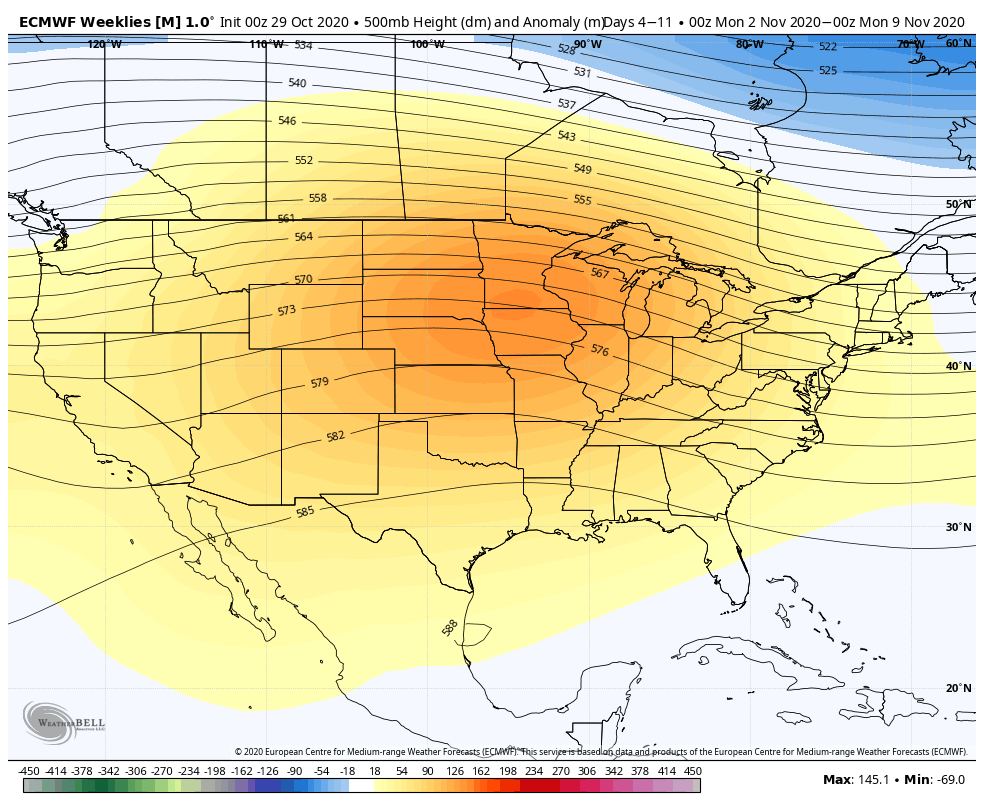
This lift of the jet stream holds its course for some time, and it’s not until the middle of the month that we start to see some amplitude in the pattern (peaks/valleys in the pattern as opposed to east/west flow).
There are signs this pattern changes into mid-month, but not really for the better as far as an overall weather pattern – the signs point to a western trough and eastern ridge. While the long-range models can’t show the day to day, we know that the atmosphere likes equilibrium, which means that what goes up, usually comes down – eventually. Therefore in between these bouts of less-than-desirable temperatures, we could have short spells of cool air. Based on teleconnections, the nationwide ridge would begin to break around 11/7 (North Atlantic Oscillation and Arctic Oscillation are less-positive), and perhaps are more significant pattern chance around 11/16-11/20 when the NAO and AO begin to trend negative.