It’s not often that we see a tropical system turn cold, until you try to bring in a triple energy phase during the transitional season.
While we’ve seen plenty of October snows, we haven’t seen many that coincide with tropical moisture. Tropical storms typically bring warm air and block any cold air intrusion, but we have a strong cold Canadian air mass that wants in to the Northeast.
Easiest seen on the Weather Prediction Center’s surface map, we have a classic T-shape mid-latitude cyclone that’s maturing and feeding off the energy transposed into the storm from Hurricane Zeta. Also noticeable is the front that is draping down across the Great Lakes into New England, and the strong high pressure pushing that cold air into the Northeast.
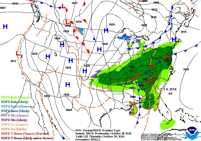
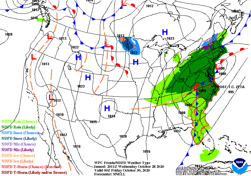
A coastal low develops ahead of the system, creating a double-barrel low pressure system moving through the Mid-Atlantic, and producing a fair amount of precipitation for southern New England and some stretching into northern New England. The problem with strong high pressures, is that they are cold and dry. Therefore the dry air will eventually start to erode the northern flank of the precipitation shield. This is a NY, southern VT, southern NH focused snow event.
We’d like the low to track just slightly more west to make a substantial October snow event, but we take what we can get from Mother Nature (especially considering what the long range looks like). Mount Snow will win this one with 3-5″ expected… Wildcat, Attitash and Hunter not terribly far behind with 2-4″.
Despite the high pressure stealing some snowfall from us, we’ll reap the benefits of that cold high Friday into Saturday with temperatures falling into snowmaking ranges in all NY/VT/NH locations into early Saturday morning. The bigger and better cold, however, comes later Sunday into Monday morning. More to come on that!