While the cold blasts are taking their time coming in, and not hanging around incredibly long, they are at least…coming in.
The first enters the picture this weekend, and there is some lingering cold throughout the northern tips of ME/VT/NH throughout the week. However with rain expected during the week, it’s not the most guns-blazing rally for snowmaking in most locations.
Remember last week’s long term views touched on a low moving across the U.S., potentially combining with a tropical system along the eastern seaboard. Well, we do have Epsilon, roaming in the Atlantic, and a boundary nearby on 10/26, but no phasing of the two. That is good news, and the winner of the three models is mostly the GFS for placement of precipitation/lows (not intensity, there’s no massive tropical system in the Gulf), but the Euro for the lack of cold air intrusion in the east at the time.
Most eyes are focusing on next weekend. There are some promising features from the European model with a slightly negative Arctic Oscillation and North Atlantic Oscillation trying to take hold beginning November 1. However, the GFS completely disagrees with it, and still brings about raging tropical systems through the first 10 days of November. Therefore, it makes sense why it’s not pegging a negative AO/NAO feature.
Looking beyond next weekend, it does not look favorable at this point. Of course we’re talking fairly far out, but the first half of November is looking relatively warm with a large ridge draped over the lower 48. This keeps all the cold bottled up north.
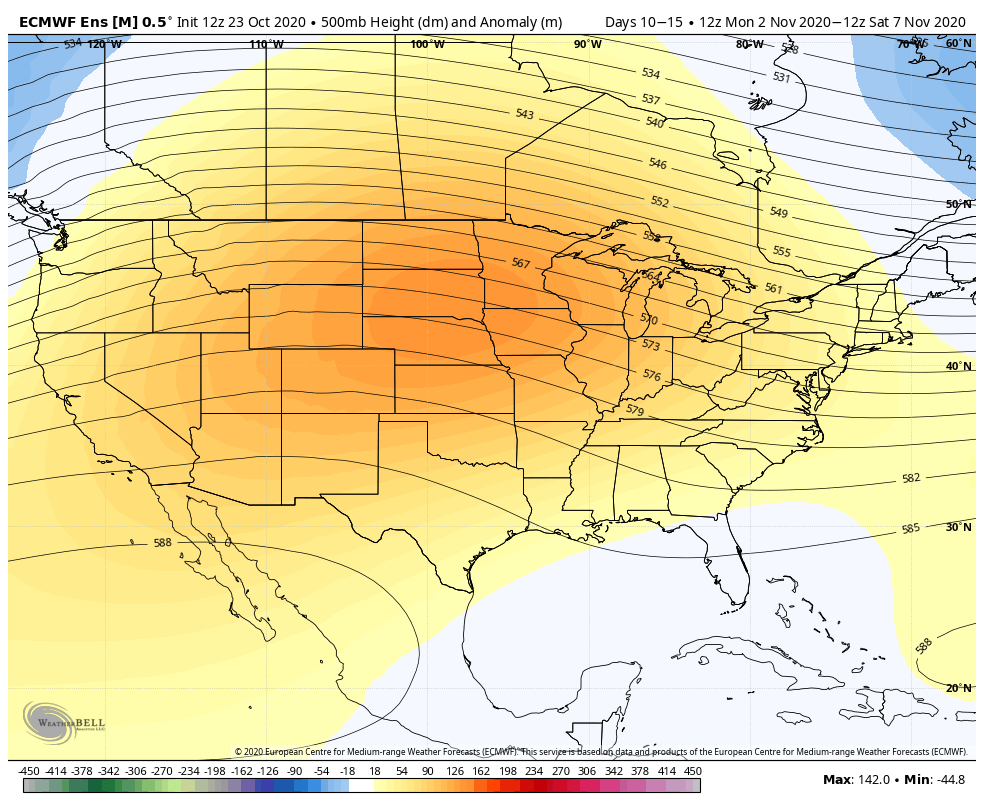
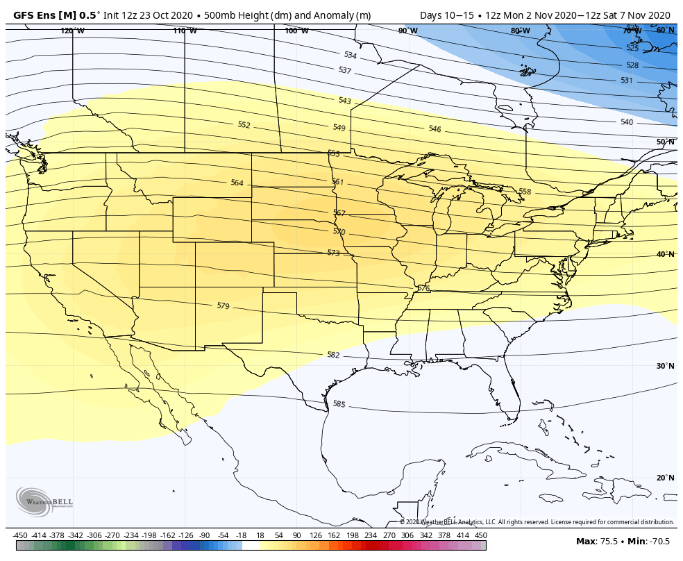
Therefore the cold blasts we see from the this weekend into next weekend might be all we see until mid-month. Again, with tropical systems still looming and brewing in the Atlantic basin, long term forecasting is all the more volatile. Hopefully back with better news on 10/30.