In general, October snowmaking windows are short, but ours have been less than that or generally non-existent. Looking at the pattern ahead, the volatility we spoke about in the October 2 blog continues, and the tropics don’t seem to want to cool down.
We’re in the midst of potentially the first summit snows for most high elevation resorts in New England. Don’t expect it to hang on long, but nonetheless, it adds a nice ambiance to our fall activities at the mountain. With tropical activity ongoing, the jet stream has not been able to sink south with any luck, and therefore the pattern remains progressive for the next week.
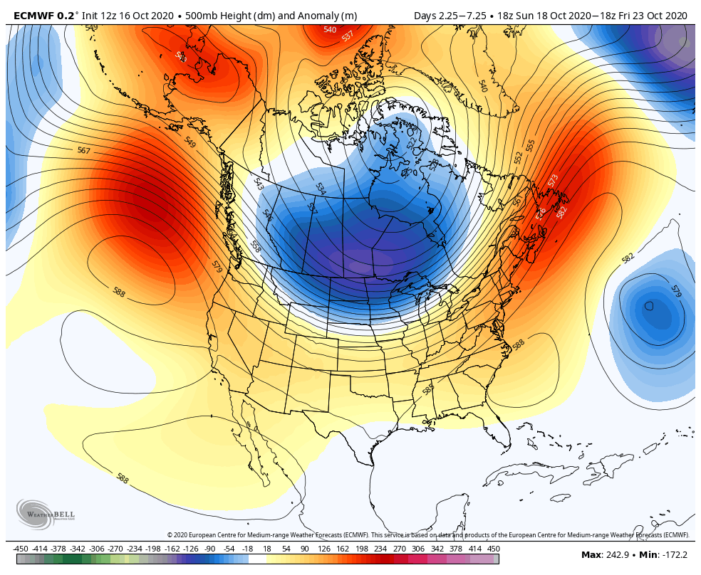
Now I’d call that some pretty decent agreement between the American and European models. Unless you’re in the northern Plains, this doesn’t look to be a very exciting pattern for cold.
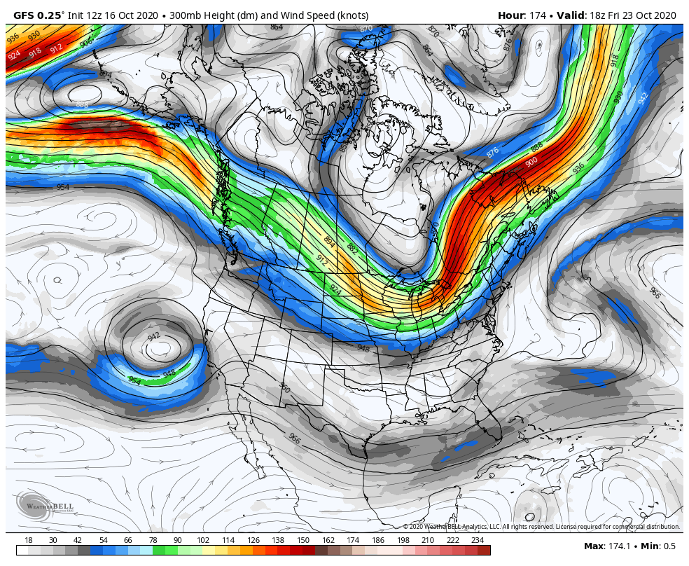
I mentioned the 10/2 blog earlier; it painted October as a fairly volatile month with quick movements in temperatures and high energy weather patterns. Aside from the current weather system, I would call this coming week a bit boring, but the following week looks to make up for it. Perhaps I jinxed us by mentioning the October 2017 wind storm and the Perfect Storm of 1991, because there are hints of a tropical low getting wrapped up into a passing low/cold front moving across the eastern U.S., which is what happened in the aforementioned storms.
We’re 10 days away from this, so plenty of time to change exact locations and features. But the take-home message is that we’re going to be on a wild ride toward the end of the month. Until we get that bulldozing low pressure and polar air mass to stake its claim into northern U.S., snowmaking opportunities look minimal at best. This system doesn’t necessarily have to knock out power, uproot trees and pummel us, it just has to be strong enough to allow space for the cold air to come in. It could go entirely offshore. However, there is consensus that we should be seeing a strong system, whether it hits us head on or not, to change the pattern in the last week of the month. This, of course, is contingent on the tropics shutting down as well. As long as the tropics remain active, cold air will struggle to move south, and stay south, for any prolonged period of time.
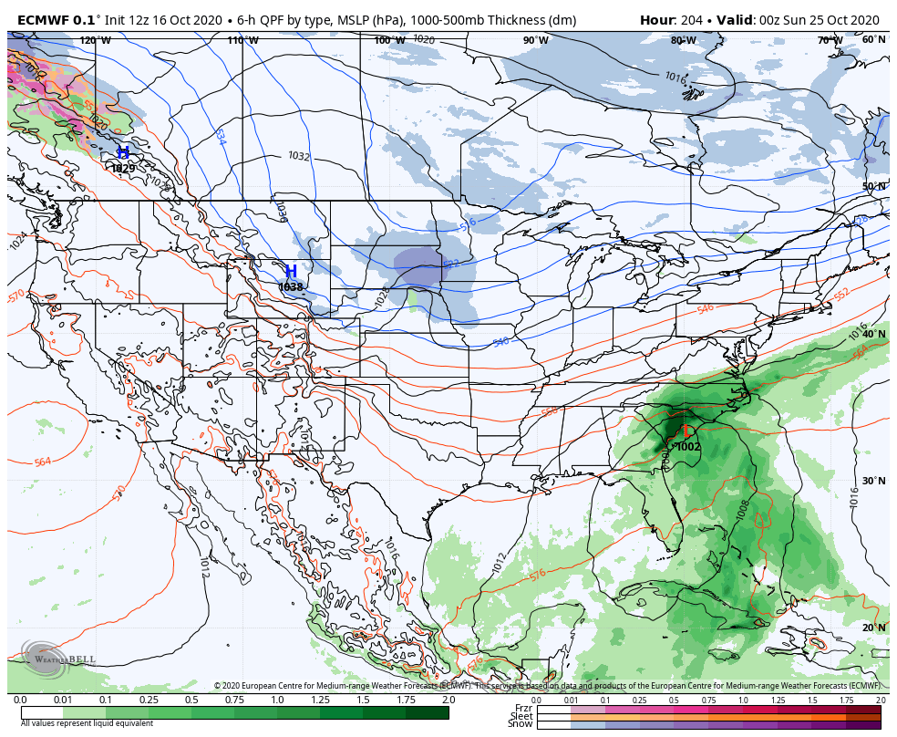
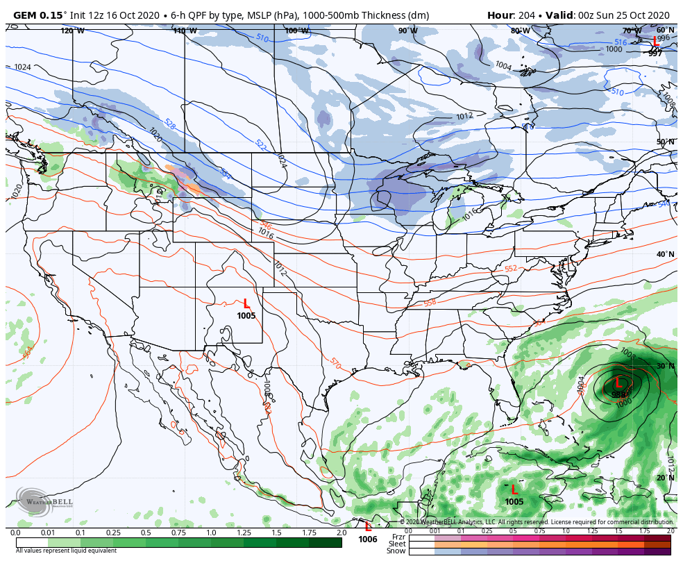
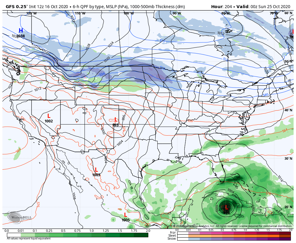
Below is a look at the evening of October 24th. In all instances, there’s cold trying to dig, and a low trying to make something exciting happen. It’ll be interesting to see this unfold!