In a typical October fashion, we’re moving through all the seasons in a short period of time. Summer like conditions returned last weekend along with severe thunderstorms, bits of spring and fall came through afterwards with wind, rain, and raw days, and now we might be entering into a brief zone of winter.
Low pressure develops along a cold front later Friday and strengthens heading into Saturday. As the long strengthens, the cold conveyor belt of air traveling along the north side of the low (and circling counter-clockwise around it) begins to crank up the amount of cold air intruding into the low to mid layers. Areas above 2,500 feet stand to receive several inches of heavy, wet snow Saturday at Sugarloaf, a maybe a bit at Sunday River for the tops of Locke, Barker, Spruce, Aurora, and potentially a little farther down the mountain for Oz and Jordan.
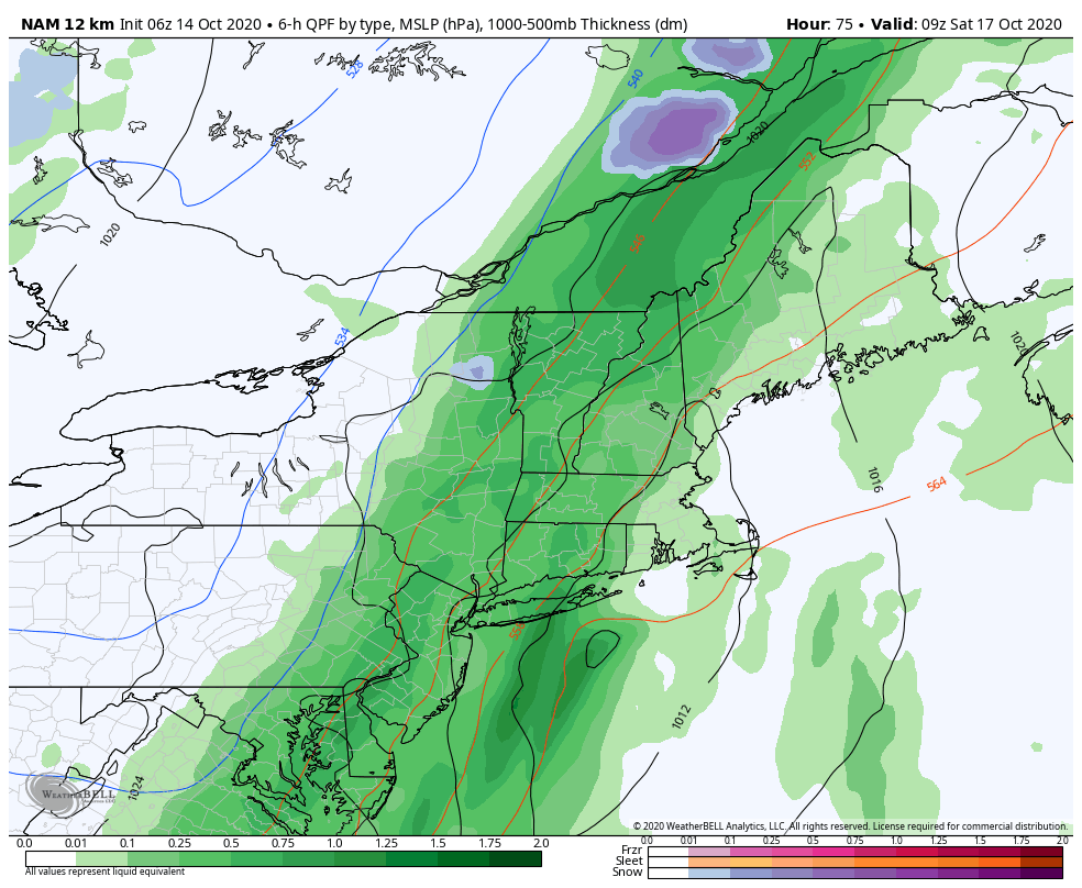
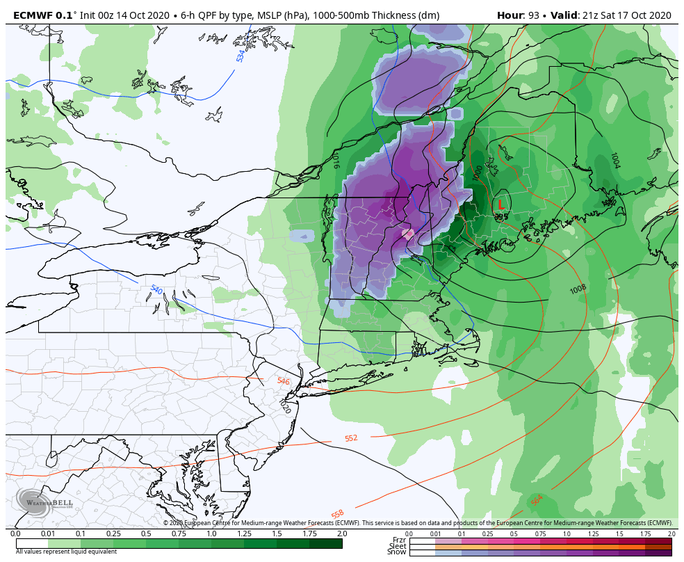
While the feedback from the model shows fairly widespread snow, most of this will occur at mid to summit levels. That’s not to say that in some intense bands we couldn’t see some snow reach the base, but it would likely melt on contact, or melt as soon as the intensity lets up. Base temperatures should stay 35-38 degrees, whereas mid levels hover around 32-35 degrees, and summits get down to 28-32 degrees. How quickly this occurs depends on how quick and deep the low strengthens. Nonetheless, this heavy, wet snow may bring down any weak branches/trees, and potentially lead to power problems in higher elevations.