The big story heading into this week is the cold blast that comes into the area Thursday and Friday. However, it is short lived.
Temperatures ahead of the front will boost to seasonable or seasonably warm levels, before the one-two punch of cold fronts comes through on Wednesday/Thursday.
Temperatures will likely fall through the day Thursday in Maine as the wind picks up out of the northwest. The summit of Sugarloaf will likely drop into the mid 20’s well before sunset, kicking off over a 24 hour period of snowmaking possible for highest elevations of Sugarloaf. That window narrows considerable heading down to 2,500 feet, where there may only be a 6 or so hour window where the wet-bulb drops below 28.
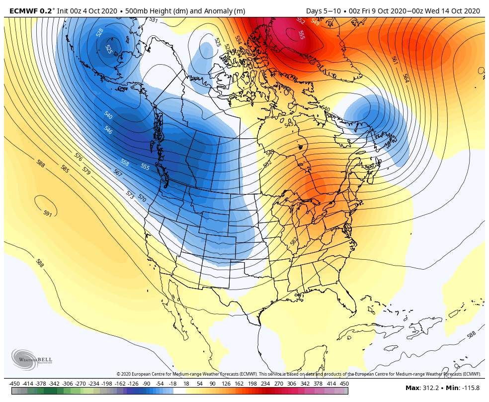
The other piece to this puzzle is the warmth that comes in fairly swift behind the cool down. By Saturday we’ll be back into the low to mid 40’s at the summit, and potentially closing in on 50 degrees Saturday evening ahead of another cold front that sweeps in. That again will drop temperatures back down through the day Sunday, and we could reemerge into snowmaking levels Sunday night into Monday (10/12). There are some inconsistencies in the pattern following the cool down on Monday; we certainly warm up again for a couple days (as seen in the 10/9-10/14 image), however the depth of that warmup and how quickly the next cool down arrives is still quite a bit uncertain.