It’s been a season of waiting for some consistent troughing the east, and – we’re still waiting. This was expected to be an “off” year – of the likes of 2011/2012, 2015/2016. When asked about how I felt about the upcoming winter last fall – I said to many clients that we were due for not-so-great winter. It typically comes, at least in the last 20 years, every 3-5 years – we had 3 solid snow years, so we were due. All things considered, this was a decent “off” year, as we at least had plenty of snowmaking opportunities to offset where Mother Nature just couldn’t pull it together.
So now we’re 2 weeks from the Equinox, and the EPO (Eastern Pacific Oscillation) is finally tanking, but is it just too late to get anything rolling? I’ve given up on the 4 nor’easters in a row of March 2018 (not that I really thought it would happen, but it was a nice memory) – I mean, one would be great at this point. What brings me some sliver of hope is that the NAO (North Atlantic Oscillation) actually falls close to neutral and even negative at a couple points from the end of this week to the end of the month. Same goes for the Arctic Oscillation (keeper of the Polar Vortex) – which means we could be not only feeling a slight arctic intrusion by the third week of the month, but we could also hold it. However, at this point we have the increased daylight and sun strength working against us – so there is a little balance to be had.
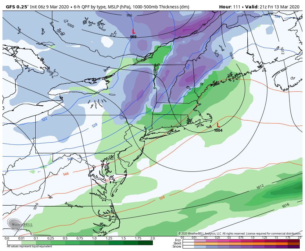
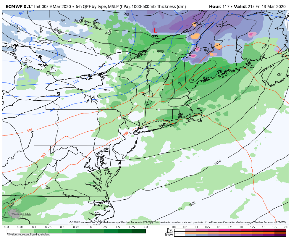
Our PA Resorts are winding things down this week as temperatures boost to near 70 degrees on the the hill. Farther north, it’s not exactly chilly and we’re tapping into some spring fever. Unfortunately the dreaded ‘R’ word is in the forecast quite a bit this week – first into Tuesday (mostly late afternoon and evening), and again possibly Friday (we saw the 3/12 event last week in the blog) – though we could pull snow for summits, maybe mid-mountain if we can just hold a little bit more chill to the air. The GFS (American model) has been developing a coastal low with this system, which is an outlier of the models but not completely bogus – and if that coastal low does form, the colder air should wrap back in quickly and we should see a better-looking event. The difference maker looks to be the speed of the shortwave – the GFS is slightly slower which is allowing this secondary low to form, while the Euro is faster and doesn’t give it the opportunity. This piece of energy comes onshore tomorrow morning so we should have a better look at it by Tuesday evening. Here’s a look at Euro w/o the coastal low, and GFS with the coastal low. It makes a big difference!