If we want to find the silver lining, it’s that we won’t see a total washout of a rain event for Vermont. There is a chance of rain mixing at the bases, but above 2,000 feet we should be seeing snowfall. While the EPO/NAO turned neutral, it wasn’t enough to lock in the cold air, even with the southeasterly flow that usually helps us out.
Attitash and Wildcat will likely take home the “largest storm of the season” medals with this one. Given the negative tilt of the trough as it moves over the region, I wouldn’t be surprised if there was thunder-snow (I’ve put in a chance of lightning at nearly all New England resorts) Thursday morning.
Hunter and south, it’s another rain event, with a cool down to follow for all resorts.
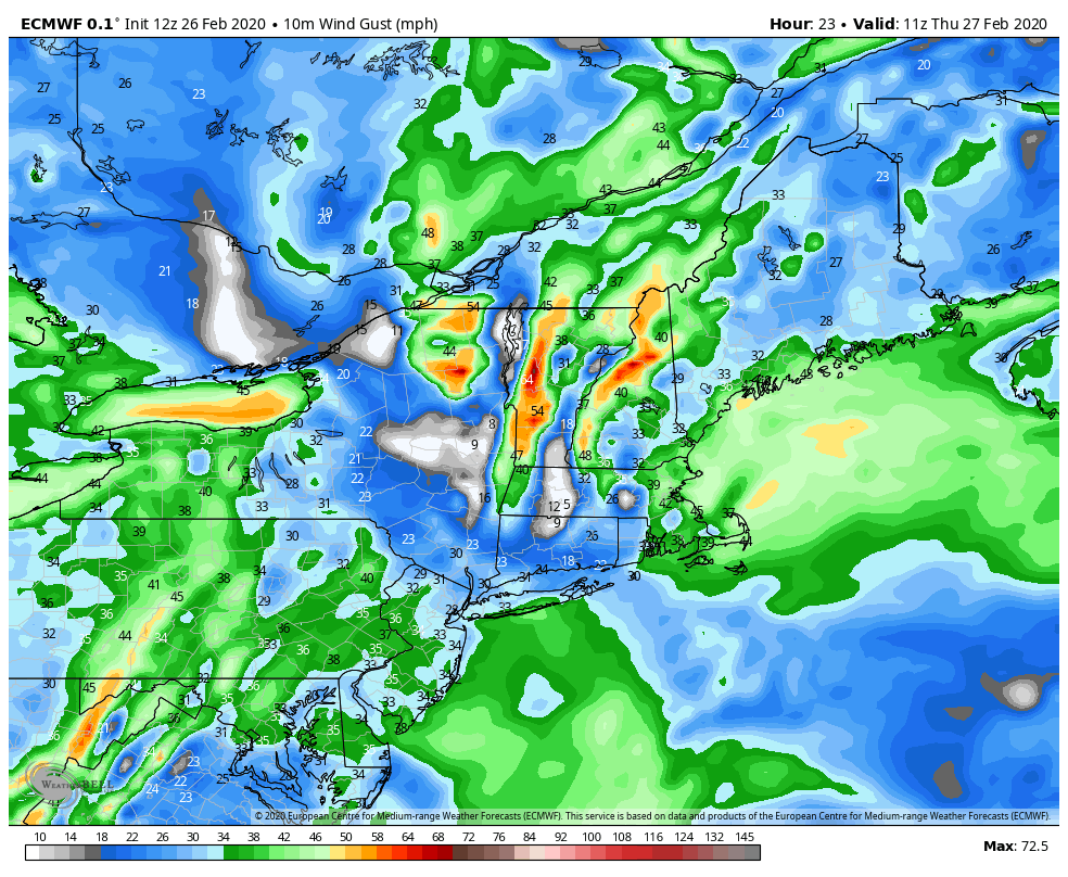
Perhaps a larger issue on top of precipitation amounts will be wind. Downed trees are lines are a major possibility going into Thursday, and even Friday for areas with heavy snow still on trees (if it makes it that long). The wind, however, will help dry out the concrete snowfall heading into the weekend, and while staying breezy, won’t be as windy for Saturday/Sunday.