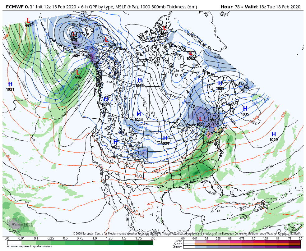
With the lack of blocking, or a negative NAO/AO in our teleconnections, our best bet are well-placed high pressures, and it looks like that may come into line and in our favor for the 3rd storm in a row. Notice the wall of high pressure systems from the Midwest into eastern Canada – this is essentially paving a very specific pathway for the storm system.
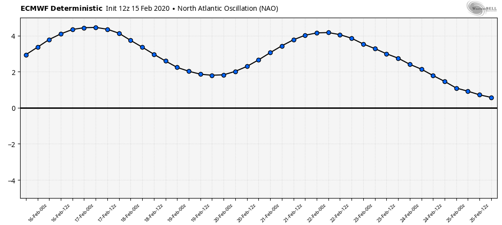
Now the question may be, well if there’s not “blocking” with a negative NAO, then what are we missing? It’s the placement of the high pressure, and the strength of that pressure. Ideally we’d have a strong high to the northwest of Maine and it would drive a coastal storm to develop, and also slow down the movement of it. However, you’ll notice that the NAO does take a dip in that time period, which is why we’re likely in a more favorable spot and seeing less of the “R” word in the forecast.
Favorable doesn’t mean all snow, however. I still think we’ll have mixing for Mount Snow (and Okemo) with sleet/freezing rain, slight chance there’s some very light rain to finish it. Attitash and Wildcat (along with Stowe) may keep all snow. Hunter will run through all precipitation types, and there’s a slight chance of some freezing rain to start for the PA resorts. Will continue to keep close eyes on the forecast.