Since posting the video blog around 9am this morning, we’ve started to see some more snow transition occurring. Intermittent snowflakes already at the summit of Mount Snow, and at the base/summit of Wildcat/Attitash.
As the low ramps up, the warm layer aloft could still be moving around, which means we could still see some mixing with sleet throughout the day, but snowfall amounts may be lending themselves toward the higher, “ideal”, amounts I had mentioned in the blog on Wednesday.
I haven’t seen any lightning strikes, but I can’t rule it out completely.
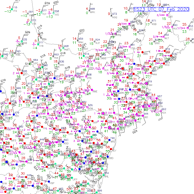
Based off the surface map, there’s still plenty of mixed precipitation around so I wouldn’t be surprised with some switching back/forth from snow to other precipitation types briefly. The sideways “S” shape is freezing rain, asterisks are snow (2 for light, 3 for moderate, 4 for heavy), circles are rain (same sequence for 2,3,4 as snow), and the barbell icon is unknown precipitation – that usually means a mixture and the sensor can’t figure out what it is. For today, it’s most likely sleet.
Hunter’s temperatures are already coming down too. All of these signs point toward more snowfall, which is a welcomed sight this winter!