Perhaps the most commonly heard phrase from clients this winter is…
Where did winter go?
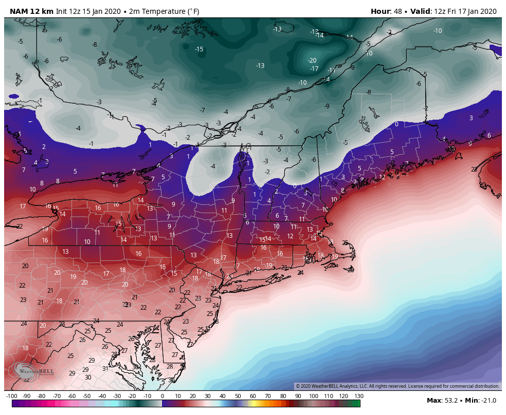
It seems like we get some cold, even some snow, and within a couple days the whole pattern breaks and it’s warm & rainy. Well, we have some better news. In the January 4th blog we outlined the thaw through 16th, and then we may see some visits from the Polar Vortex. Here we are on January 15th, and forecasting some frigid temperatures for Friday & Saturday, but also natural snow on each side of the cold temperatures (for VT/NH – a mix of rain/snow for PA & NY), something that hasn’t happened for more than a couple days prior to the season.
Let’s start with Thursday – low pressure rides along the eastern seaboard (though quickly), bringing a nice “refresher” course of sticky snowfall to Mount Snow, a little lighter in nature for Wildcat & Attitash, and rain to the south. While it’s a quick 2-4 incher, maybe 5-6″ for NH, the cold behind it is the bigger story. We have snowmaking ranges opening up for all Vail Resorts properties Thursday night into the early hours of Friday. It will be a cold day, likely stripping whatever moisture was left in the snow, and thankfully wind will be subsiding as well.
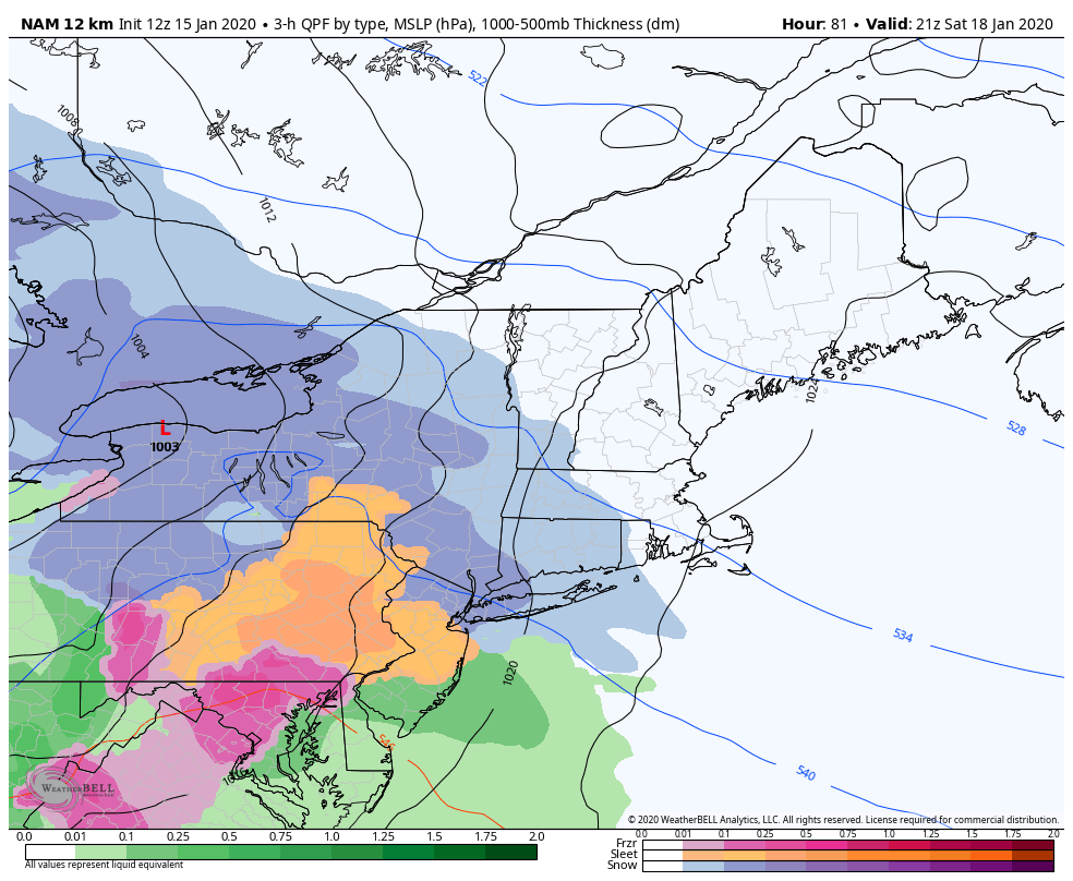
Moving into Saturday, the next system arrives in PA during the morning hours. Some minor snow accumulation is possible (<2″), before changing over to sleet and freezing rain. It does look like the inversions hold for the majority of the event, but some rain will be possible to finish it off. Temperatures at Liberty and Roundtop will be a rollercoaster in the overnight period, as we’ll likely break the inversion in the upper 20’s, shoot up into the mid to upper 30’s, and then drop back down into the low 30’s while everyone’s dreaming of skiing. Temperatures will then steady off and eventually drop Sunday, with snowmaking conditions returning.
While PA is switching over precip types, Hunter is starting as snow too Saturday afternoon. The majority of the heavy precipitation should come down as snow, providing a nice 3-6″ possible at Hunter before any changeover/mix with sleet, and then a little rain which will be brief. Similar to Liberty & Roundtop, the temperature rollercoaster ride will be quick and during the overnight.
Mount Snow, Wildcat and Attitash look to reap the benefits from the incoming system, with 5-8″ likely and no mixing. The snow composition will likely change during the storm – starting off soft and powdery and becoming more wet/sticky toward the end when the temperatures rise.
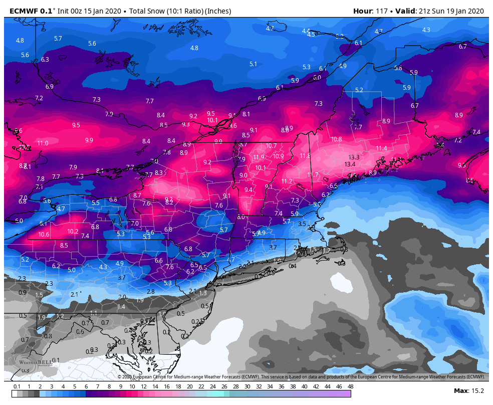
Arctic air returns behind the weekend system, which should allow for an amazing setup on a holiday weekend. Folks can get to the resort Saturday, hunker down into Sunday, and be able to leave Monday. No warmth keeps the snow from Thursday’s and the weekend storm in place. Wind could be on the higher side at summits Saturday night through Sunday night, but looks to come down in time for Monday.
Teleconnections don’t point to another significant system until the following weekend (Jan 26/27), so the snow will be here to stay during the week. I’m going out on a limb here, but today may be the warmest day we have for the rest of the month.