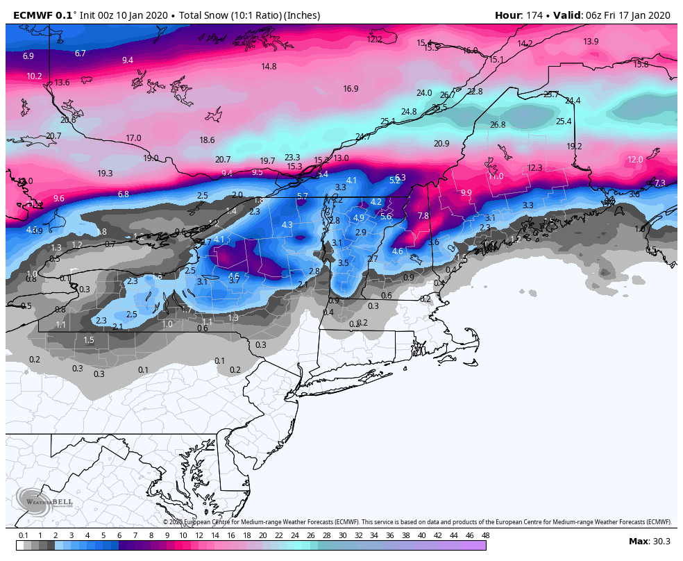
As we hinted at in the last blog, we’re at that dreaded “thaw” point with the “R” word in the forecast much more than any of us would like to see. What was foreshadowed has unfortunately played out as planned, however we did see a bit more snow in the days preceding the rain than initially expected…so we’ll take that as a win.
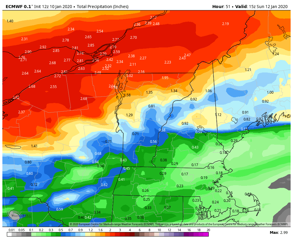
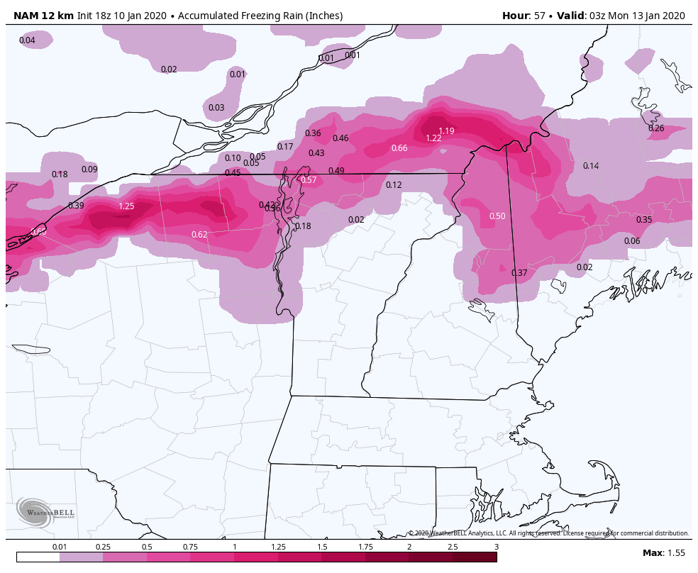
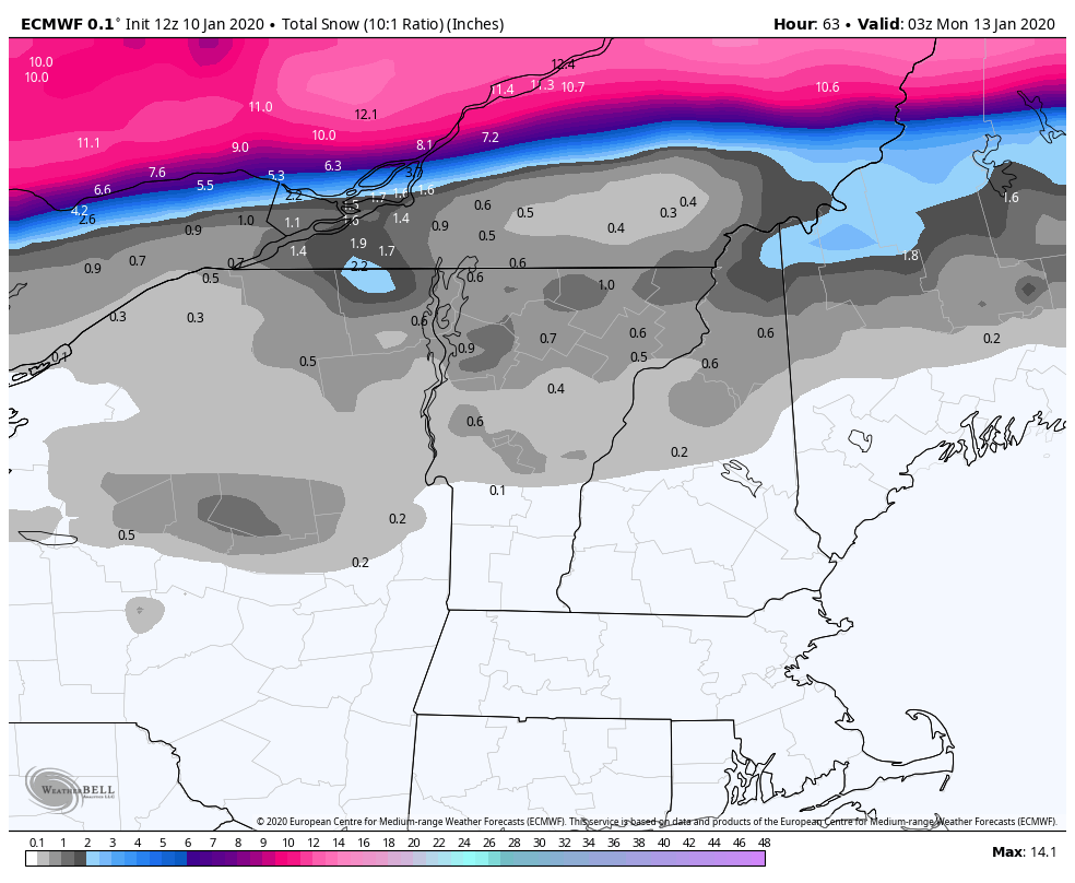
Let’s brush over this storm quick – rain is impactful for all resorts Saturday night into Sunday, with Wildcat and Attitash potentially seeing icing as well. However, as the buzz word “ice storm” has circulated for the second time this season, this particular setup is not conducive for significant icing; fast moving storm, heavy precip intensity, and warmth prior to ice do not scream massive ice event. Therefore the recover from both rain and ice should be quick. Remember we had a similar storm last year right after MLK weekend, so it somewhat seems like a right of passage at this point.
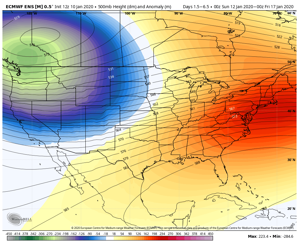
Alright, let’s wipe the slate clean from that mess and look forward to some uplifting news! We’re seeing some shifts in the teleconnections that are exciting. Models have already started to pick up on these and create some exciting storms in the long term. Referring back to our teleconnections blog, we’re looking for a negative EPO (eastern pacific oscillation) pattern, which provides ridging in the west and troughing in the east. Troughing in the east dips the jet stream down along the eastern seaboard not only to allow some cold air to intrude, but provide a favorable storm track for systems. This gives us the signal that we may have the potential for a “blockbuster” storm, so I’ve been looking at the other factors. The NAO (north atlantic oscillation) doesn’t take negative for long, but there are dips, which is intriguing. The NAO is a great guide to see if there’s blocking in the atmosphere – or a way to trap the cold air and slow down the movement of a system. We see that around January 20, and the Canadian even has a secondary dip around January 24. While no prolonged arctic outbreaks are expected, I would not be surprised to see a few brief visits from the Polar Vortex. The AO (arctic oscillation), which is essentially a measure of the Polar Vortex stays mainly positive in the upcoming time frame (which means the core of the polar air stays in the arctic), but there are signs of a few dips toward the end of the month (perhaps after MLK and then again into February). While a negative AO is preferred, it’s not necessary to get some good storms to move through the region.
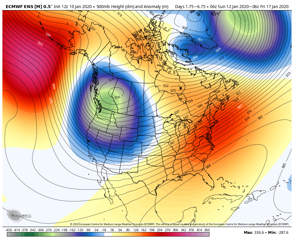
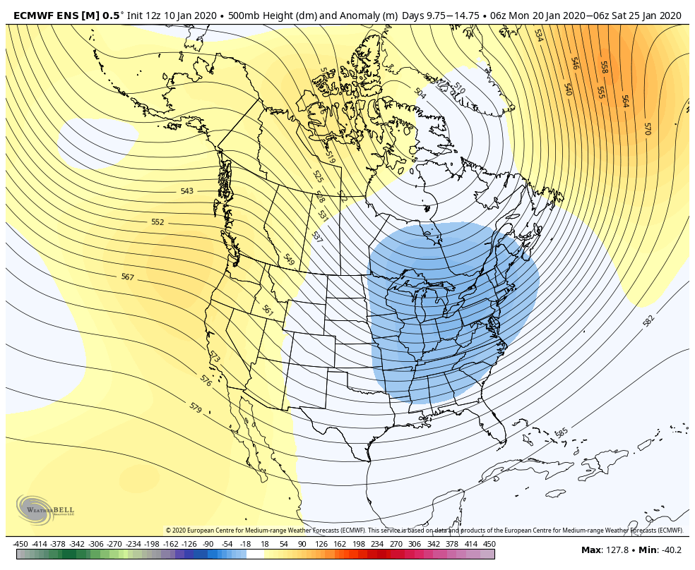
Notice the flip flop in heights (low heights equate to troughing, higher heights to ridging) as we go from pre-MLK weekend to post.
Before we get to the post-thaw point, which is not technically over until around Thursday of next week – there are two more systems to come through – Tuesday night and Thursday. Both have the potential of being mixed, but given a slight shift in track to the east, could be two decent light snow events for us to bounce back even quicker into MLK weekend.
Thinking snow!