While winter is showing up in doses, the sustained cold is having trouble hanging around. That leaves us in a progressive and volatile pattern, with temperature swings and mixed precipitation storms and outputs. Each storm will determine its dominant precipitation type – whether we have cold air damming and can hold some cold, or we end up with the dreaded R word.
The cycle of storms began before the the New Year with the ice block that hit Mount Snow, rain/ice for Hunter, rain for Liberty/Roundtop, and snow for Attitash/Wildcat. Our second is ongoing right now – fairly weak in nature and struggling to ingest the cold air in because overall weak wind flow. We should see a changeover at Mount Snow in the evening hours, whereas Wildcat and Attitash should see all snow through the event – maybe some light rain at the Attitash base but webcams have been showing some snowflakes even with temps in the mid 30’s.
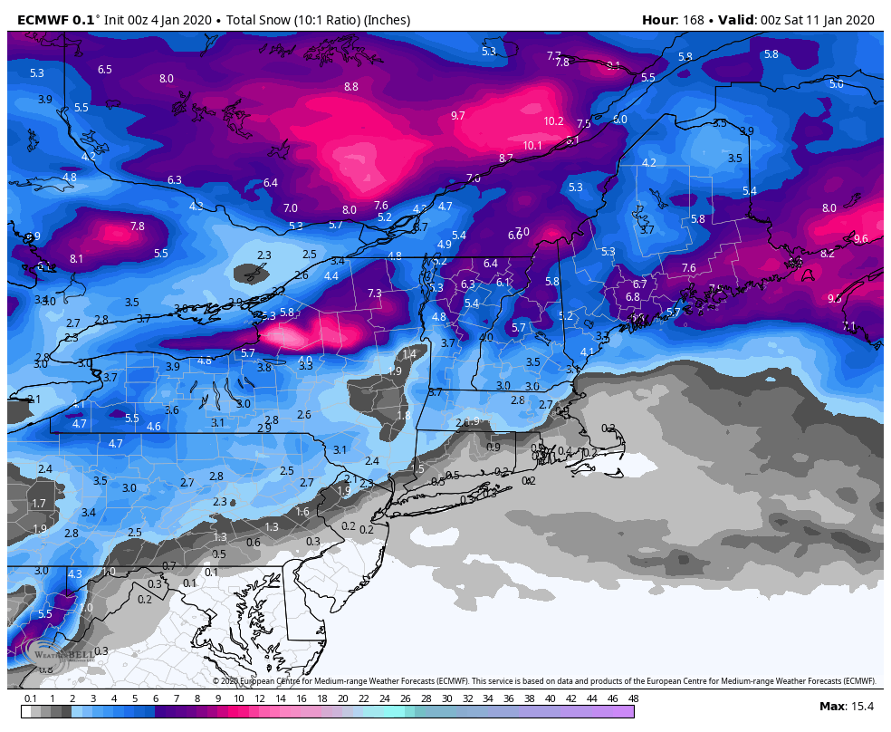
So what’s next? We have a weak wave coming through Monday that could bring a quick refresher inch of snow to resorts Hunter and north – followed by a seemingly more interesting storm on Wednesday. Models have been dabbling with a deepening coastal low with this system, but have backed off recently. With such an active pattern, it’s hard to imagine that all of these systems are 1-3″ clippers, so I’m keeping close eyes on these two pieces of energy. Between today’s light snow, and the two incoming pieces of energy, we may pick up 3-6″ of snow Mount Snow and north (under current projections – more is a possibility). Liberty & Roundtop may see some light natural snow on Wednesday as well.
The good news, at least while Mother Nature waffles around on what part of winter we want to be in, is that through the Wednesday system (and likely Thursday), temperatures are favorable for snowmaking Hunter and north. Tuesday afternoon may sneak out of range for Hunter & Mount Snow at the base, but it would be momentary as some cold air drains in during the afternoon ahead of the incoming system Wednesday. This punch of cold also looks to give Liberty & Roundtop some snowmaking opportunities Monday night, and again Tuesday night through Thursday night (might not be continuous but it’s not far off). Signs are that an arctic punch follows the Wednesday system, but as quickly as the cold air comes in, it looks to retreat.
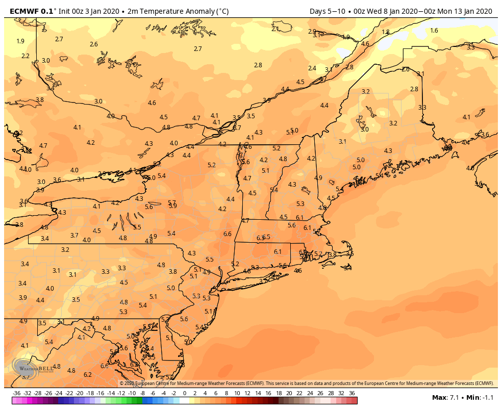
I’m going to label this as the obligatory January thaw, because there are signs that following mid-month, our favorite Polar Vortex might come to play a little more often.
This is not before we could see 1-2 more large scale system come in for next weekend (1/12-1/13) and the week after. All this to say…the next 10 days or so look busy and tumultuous. Though we should hold cold through 1/9, the time period from 1/9 to 1/16 may be labeled as our “thaw”, and contain one, if not two rain events.