With the largest storm of the season heading towards us Sunday, here’s another update to supplement the video update from Friday. We’re still looking at a large swath of heavy snowfall from central NY to southern VT & NH – putting Mount Snow & Hunter in the prime positions to take home a gold medal for the most snow.
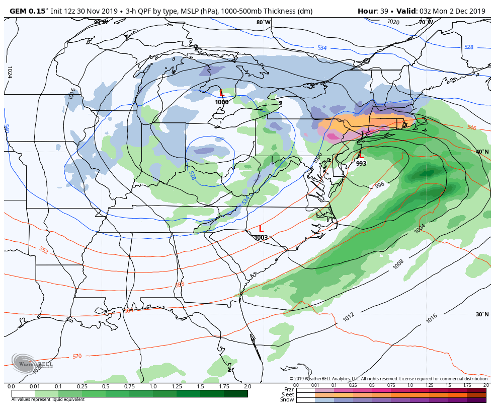
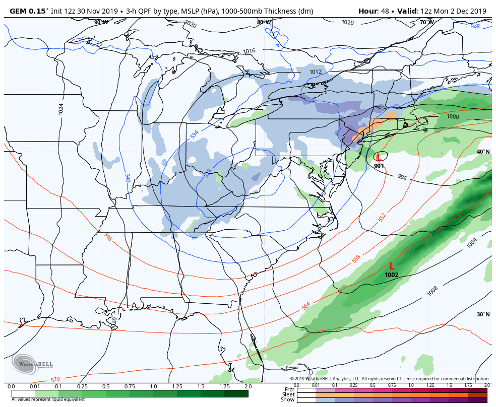
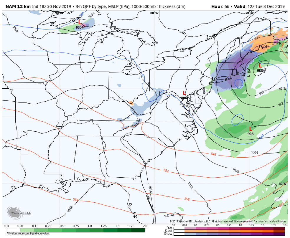
What we covered briefly in the video update was that this wasn’t our classic nor’easter. Here are a series of images showing the evolution of the low pressure centers. In the first image (Sunday night), notice that there’s a low off the coast of New Jersey and another back in Michigan. What this is showing us is that the low pressures are not “stacked”. The surface low and the upper level low are not on top of each other as you go up into the atmosphere, which fails to allow the storm to strengthen (the energy centers are disjointed). Let’s move to the second photo (Monday morning) – notice that the low off the coast has dropped pressure slightly, and we’re no longer see any signs of the low in the Midwest. A mere 24 hours later (third photo), you see a deepening low over the Gulf of Maine with moderate to heavy snowfall rotating around the low. At this point, the upper level low has stacked over the surface low, and now we have a strengthening storm (lower central pressure of the low).
Because of the delay in the our lows becoming vertically stacked, we have this “lull” during the energy transfer, creating an axis of snow that sits over central NY and southern VT/NH. This creates a continuous light to moderate snowfall during the day Monday, when most areas aren’t seeing accumulating snow. When the precipitation is fairly light, we may see some sleet or freezing rain mix in before the intensity picks up again.
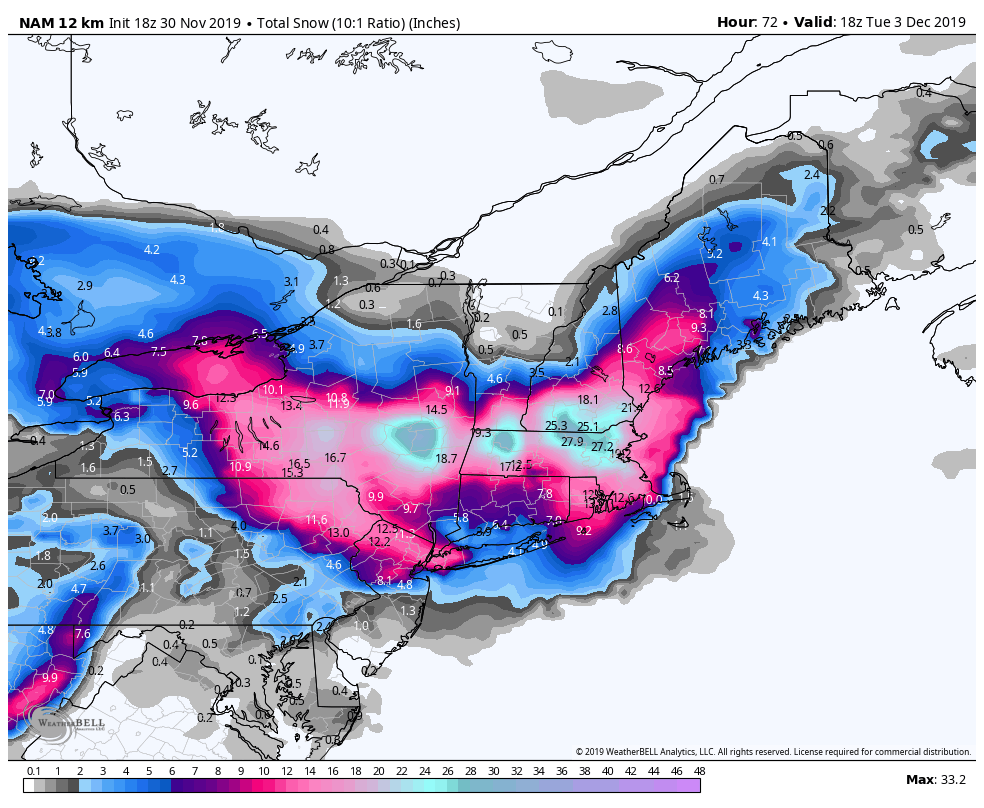
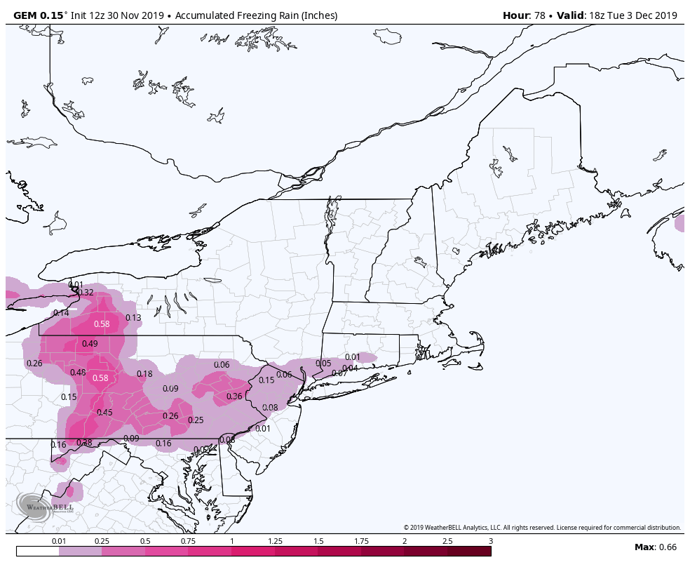
Notice the bulls-eyes in the those areas. This model, the NAM, typically enhances the snowfall amounts a bit much. While I think these totals are too high, the jackpot areas are in the correct spots. I anticipate 12-16″ at Mount Snow, and 14-18″ at Hunter. Wildcat & Attitash can expect 3-6″ and our Pennsylvania resorts will be more prone to a larger freezing rain event compared to snow. Total snow will likely stay under 1″ in the those areas.
Behind this system, the cold hangs on – which means we’ll have more opportunities for snowmaking on top of natural snow. We’ll have a long term blog coming Monday to overview the first half of December.