We’ve had cold, and we’ve had some storms, but the two combining has yet to happen yet this season. While it’s not happening perfectly (we don’t have white gold gracefully falling from the sky for 24-36 hours), we’re getting into the first of many cycles of the season beginning with our storm coming in Monday night.
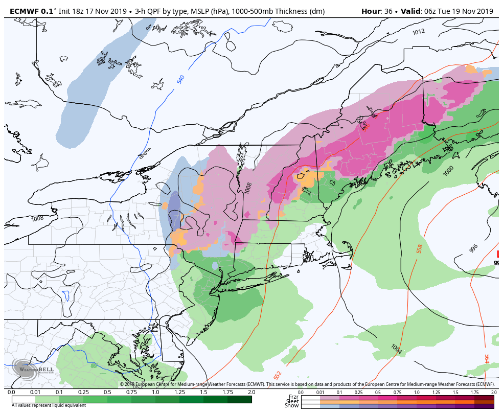
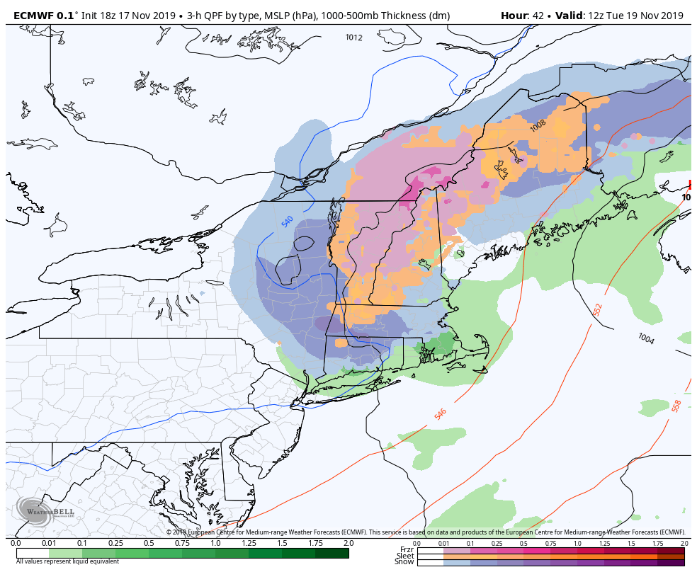
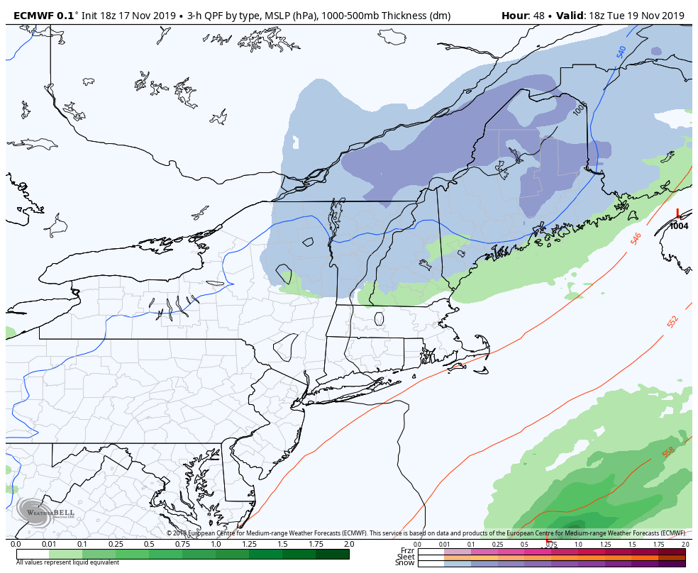
Overall, this storm is a mess. But it’s the first decent low pressure system to come in since many resorts have opened, and it’s the first of several. Let’s take a look at the succession of the storm from Monday night through Tuesday afternoon. We’re talking ice accretion up to .20″, mixing with sleet, eventually changing over to snow (1-3″ possible for MS, WC & Hunter) before hightailing it out of New England. Should be an interesting cross-section of the snow when all is said and done. The reason for this “mess” is cold air damming (CAD). It’s not the most classic case given the two shots of precipitation, but when we start seeing a relatively light northeast wind at the surface, and some southerly component in the higher elevations, the warmer air invades the mid-layers but cold is trapped in the low levels. Cold air is heavier and more dense than warmer air, so the warm air just glides right over the stubborn low-level cold. Therefore the snowflakes melt in the warm layers, and we’re left with only three options – rain, sleet, or freezing rain. Perhaps we’ll do a deeper dive into CAD at another point. But it is the culprit for bringing mixed precipitation and ice events to the Northeast.
Behind this system, wind isn’t too much of an issue. We are “cooler” into Wednesday, but not exactly cold. Snowmaking may be possible in mid & summit elevations, but the base will likely get above freezing.
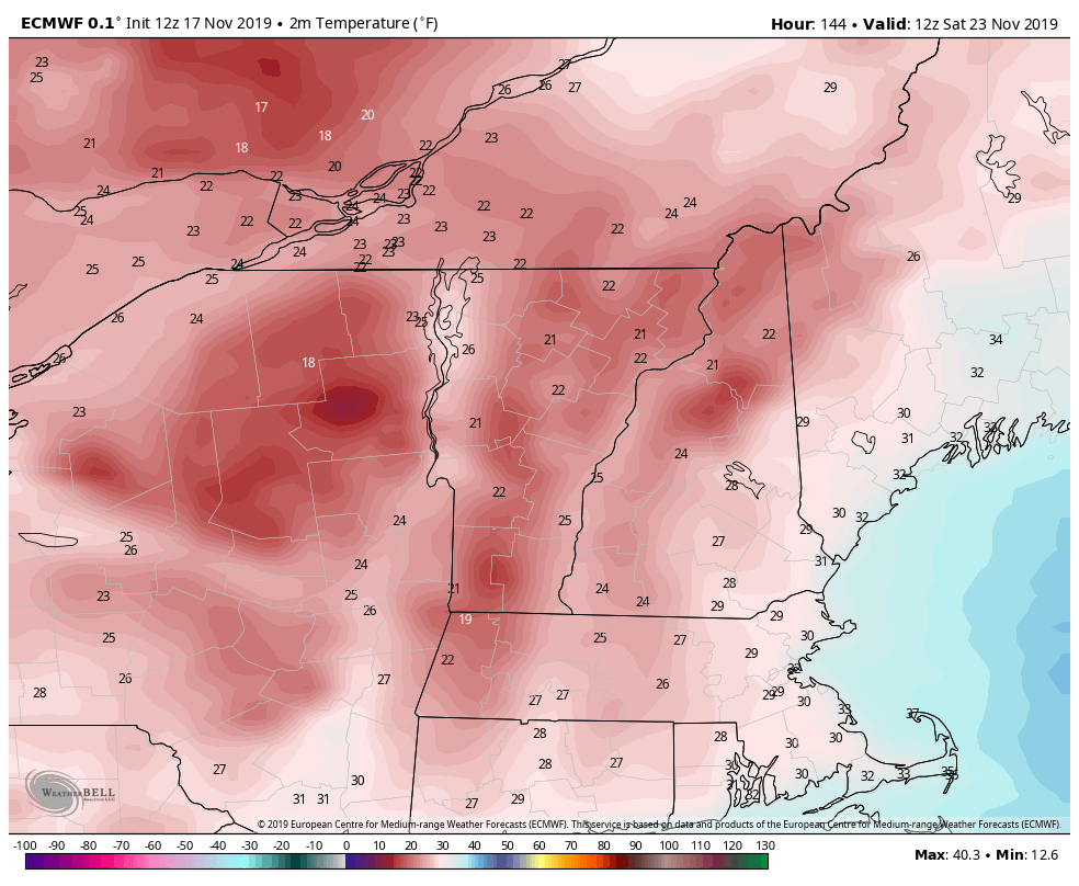
Thursday is even a touch cooler before the next system pushes into the region Thursday night. Another mixed precipitation system – but stronger – will bring in much colder air behind it for the Friday night to Saturday afternoon time period. Wind will pick up behind this system, Friday evening into Saturday. Again, cold is short-lived, before another system comes up the coast on Monday, which again, may be mixed. Looking at potentially a fourth system arrives in time for Thanksgiving dinner.
We’re seeing so many mixed precipitation storms because we have nothing to block the cold air in. Often times you’ll hear about a “blocking” pattern. That consists of a strong, cold Canadian high pressure to our NW, which keeps some component of the wind out of the north given its clockwise rotation, and also slows the movement of any storm system moving up the coast (think atmospheric traffic jam). We typically don’t see it setup up very early in the season, but as we head into mid-late December, we should start seeing those blocking patterns developing in the pattern. Until then, expect us to ride the temperature rollercoaster in this active pattern.