With the first snowmaking push underway, we’re going to take a look at how long snowmaking conditions hold in the forecast. Atmospheric energy likes to balance – it may not be immediate to do so, but it’s rare to get deep cold without some warming to equalize out the push. We’ve seen it in years past, with large January thaws, rainy MLK weekends & President’s Day weeks, just a week or two after a large cold outbreak (think Christmas/New Years 2017-2018). This was not observed last year as the cold came in gradually, and therefore we had small rolling waves of cold/warm throughout the season – more “steady-state” if you will. No major thaw, no major cold.
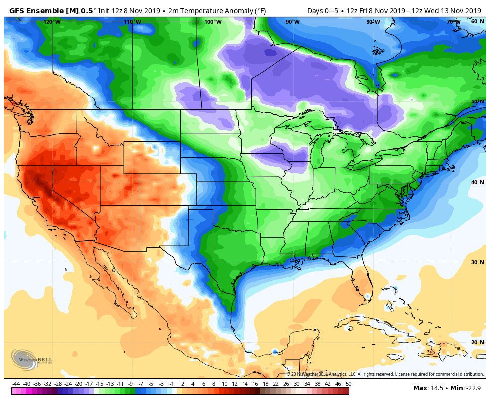
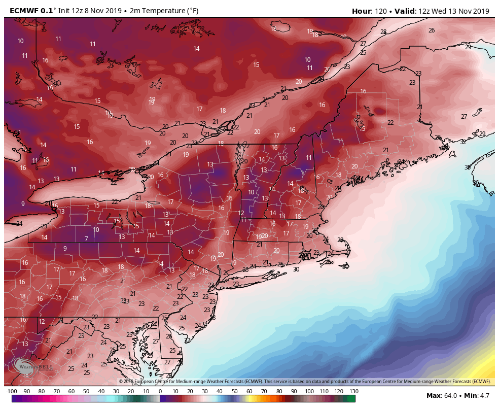
Clearly this season is already different. We’ve had two rounds of cold coming in, one fairly significant (what we’re under currently), and another to come later Tuesday into Wednesday next week. The current cold begins to ease Saturday night into Sunday, when winds subside and become more variable. “Warmth” (I say that loosely) comes in from Monday evening through late Tuesday afternoon ahead of a cold front. There will be a wave of low pressure riding along the front, which may provide mountains with natural snow as well. The cold behind this front has the potential to be record breaking, with overnight lows at bases likely to be in the single digits and summits may end up below zero.
This cold blast holds through Friday morning (11/15), ahead of another system heading up the eastern seaboard. Temperatures briefly warm as we head into the following weekend (11/16-11/17) but there are diverging signs of whether the incoming system will be more rain or mixed. It does not look like substantial cold air will be in place for it, but may return behind it briefly into the week of 11/18.
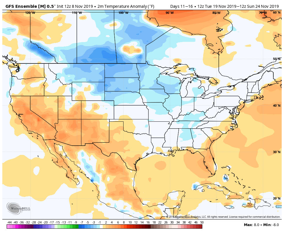
After this point, cold pushes look to be less intense and we may see more waves of cold rather than deep arctic bursts. As mentioned in the beginning, what goes down, must come up (eventually, at least in the atmosphere). Therefore by the end of the month, or early December, I see a 7-10 day period where we don’t see much in the way of snowmaking windows, and may feature more seasonably warm features as we prepare for a more permanent seasonal transition.
Mountain impacts:
Wildcat, Attitash – Wildcat has sustained snowmaking for quite some time in this push, especially at the summit where we may hold until Monday night. It will only be a minor break before the cold comes roaring back in Tuesday afternoon through Friday evening. Attitash has solid blocks throughout these cold spells as well, though the base will lose the cold temps Sunday.
Mount Snow – has similar windows but will lose the cold a little sooner Monday, especially at the base (probably Sunday we lose snowmaking windows). They return a little sooner on Tuesday as the front comes through a little earlier.
Hunter – the current push of cold holds until Saturday night, when warm advection at night gradually warms up temps… and we’ll likely lose snowmaking conditions through Tuesday morning. Temperatures return to snowmaking ranges Tuesday afternoon through Thursday night/Friday morning.
Roundtop – cold temps stick through mid-day Saturday before warming takes hold. Opportunities return Tuesday night as temperatures plummet with the frontal passage and despite peak daytime heating hours of Wednesday, snowmaking could continue through Wednesday night.